Sokkia
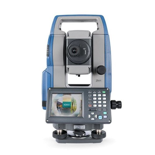
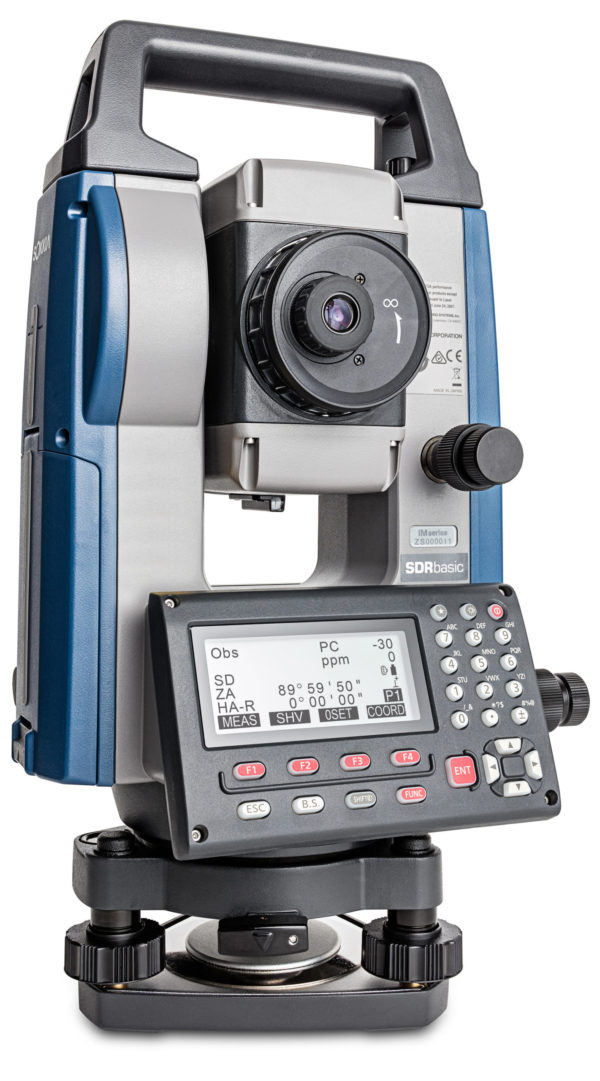
Sokkia iM-60/CoordyNavi Series
The Sokkia iM-60 Series Total Station, combined with the CoordyNavi smart stakeout application, delivers an intelligent surveying solution for construction, engineering, and land surveying professionals.
- Integrated Bluetooth® connectivity
- IP66-rated dustproof and waterproof protection
- High levels of accuracy, reliability, and efficiency
- Seamless integration with the CoordyNavi smartphone app
Telescope
Angle Measurement
Distance Measurement
OS, Interface and Data Management
General
Power Supply
Application Program
| Magnification / Resolving Power | 30x / 2.5″ |
| Length | 171mm (6.7in.) |
| Objective aperture | 45mm (1.8in.) (48mm (1.9in.) for EDM) |
| Image | Erect |
| Field of View | 1°30′ (26m / 1,000m) |
| Minimum focus | 1.3m (4.3ft) |
| Reticle illumination | 5 brightness levels |
| Minimum Display | 1″/5″ (0.0002 / 0.001gon, 0.005 / 0.02mil) |
| Accuracy (ISO 17123-3:2001) | 2″ (IM62) /5″(IM-65) |
| Detecting | 2 sides (IM62) /1 side(IM-65) |
| Dual Axis Compensator | Dual-axis liquid tilt sensor, working range ±6′ |
| Dual-axis liquid tilt sensor, working range ±6′ | On/Off (selectable) |
| Laser Output | Reflectorless Mode: Class 3R / Prism / sheet mode: class 1 |
| Measuring Range(under average conditions*2) | |
| Range (ISO 17123-4:2001) Mode *3 | 0.3 to 500m (1,640ft.) |
| Range Reflective Sheet *4*5 | RS90N-K: 1.3 to 500 m (4.3 to 1,640 ft), RS50N-K: 1.3 to 300 m (4.3 to 980 ft), RS10N-K: 1.3 to 100 m (4.3 to 320 ft) |
| Mini pole prism OR1PA | 1.3 to 500 m (4.3 to 1,640 ft) |
| Compact prism CP01 | 1.3 to 2,500 m (4.3 to 8,200 ft) |
| Standard prism AP01AR | 1.3 to 4,000 m (4.3 to 13,120 ft) |
| Minimum display | Fine / Rapid : 0.0001m (0.001ft./1/16 in.)/0.001m (0.005ft./1/8 in.) (selectable), Tracking/Road: 0.001m (0.005ft./1/8in.)/0.01m (0.02ft./1/2 in.) (selectable) |
| Accuracy*2 (ISO 17123-4:2001) (D = measuring distance in mm) | |
| Reflectorless*3 | (2+2ppmx D) mm*6 |
| Reflective Sheet*4*5*7 | (2+2ppmx D) mm |
| Prism*8 | (1.5+2ppmx D) mm |
| Measuring time*9 | |
| Fine | 0.9s (initial 1.5s) |
| Rapid | 0.6s (initial 1.3s) |
| Tracking | 0.4s (initial 1.3s) |
| Operating System | Linux |
| Display / Keyboard | Graphic LCD, 192 x 80 dots, backlight:on/off (Selectable) / Alphanumeric keyboard/28 keys with backlight |
| Operational Panel | On Both Sides (IM62)/ On One Side (IM65) |
| Data Storage Internal Memory | Approx. 50,000 points |
| Data Storage External Memory | USB flash memory (up to 64 GB) |
| Interface | Series RS-232C, USB 2.0 (Type A for USB flash memory) |
| Bluetooth Modem (Option) *10 | Bluetooth Class 1.5, Operating Range: up to 10m *11 |
| Laser Pointer | Coaxial red laser using EDM beam |
| Levels Graphic | 6′ (Inner Circle) |
| Circular Level (on tribrach) | 10’/2mm |
| Plummet | |
| Optical | Magnification: 3x, Minimum focus: 0.5m (19.7 in.) from tribrach bottom |
| Dust and Water Protection | IP66 (IEC 60529:2001) |
| Operating Temperature | -20°C to 60°C (-4 to +140°C) |
| Size With Handle (w x d x h) | 200(W)x 181(D)x 348(H)mm (Display on both sides) (IM62) / 200(W)x 176(D)x 348(H)mm (Display on both sides) (IM65) |
| Weight With Battery and Tribrach | 5.3kg (11.7lb) (IM62) / 5.1kg (11.3lb) (IM65) |
| Battery | Li-ion rechargeable battery (BDC71) |
| Operating Time (20°C)*12 | Approx. 14 hours |
| ON Board | REM Measurement | 3D Coordinate Measurement | Resection | Stake Out | Topography Observation | Offset Measurement | Missing Line Measurement | Intersection | Surface Area Calculation | Route Surveying | Point to Line |
- High-speed 0.9-second reflectorless measurements up to 500 m
- Rugged IP66-rated dust and water protection
- Reliable operation in temperatures from −20°C to +60°C
- 50,000-point internal memory with USB data transfer support
- Up to 14 hours of continuous battery operation
- Integrated Bluetooth® connectivity
- Dual-axis compensation for improved measurement accuracy


Wish to know more about this product?
Feel free to contact our specialist for expert guidance and personalized recommendations.