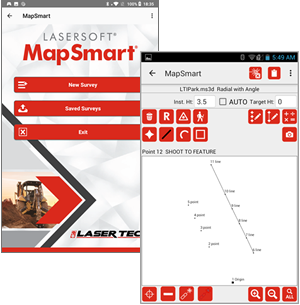
MapSmart field data collection software is designed for anyone who needs to quickly and accurately map, measure, or position anything. It’s a simple yet powerful program that easily integrates with LTI laser devices and mapping accessories to turn a laser into a complete total station solution.
Laser Offset Mapping
Laser Offset Mapping
Laser offset mapping is widely used in forestry and allow for easier and accurate data collection. Forestry requires accurate measurement with little complexity and in the shortest possible time. Laser Offset mapping can help in measuring distances, heights and azimuth with precision and speed. Terrestrial laser scanning (TLS) is being widely used in forest surveys to acquire important basic tree parameters (e.g., diameter at breast height and tree position). The laser device is further integrated with data collection software for mapping, measuring and positioning. The combination turns the laser into a total station solution.
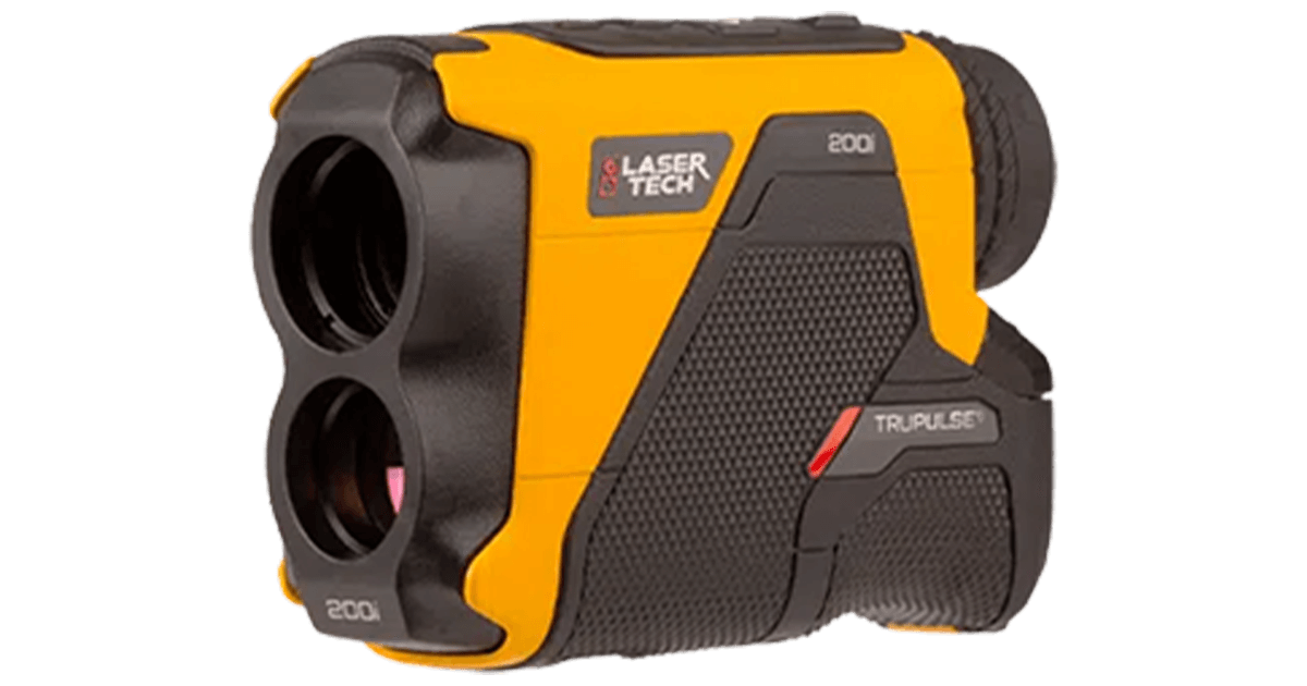
LaserTech Laser Range Finder Model Tru Pulse 200i
The TruPulse® 200𝗂 features improved accuracy and a simplified interface, making it a must-have tool. It modernizes the TruPulse 200 with enhanced performance and intuitive operation.
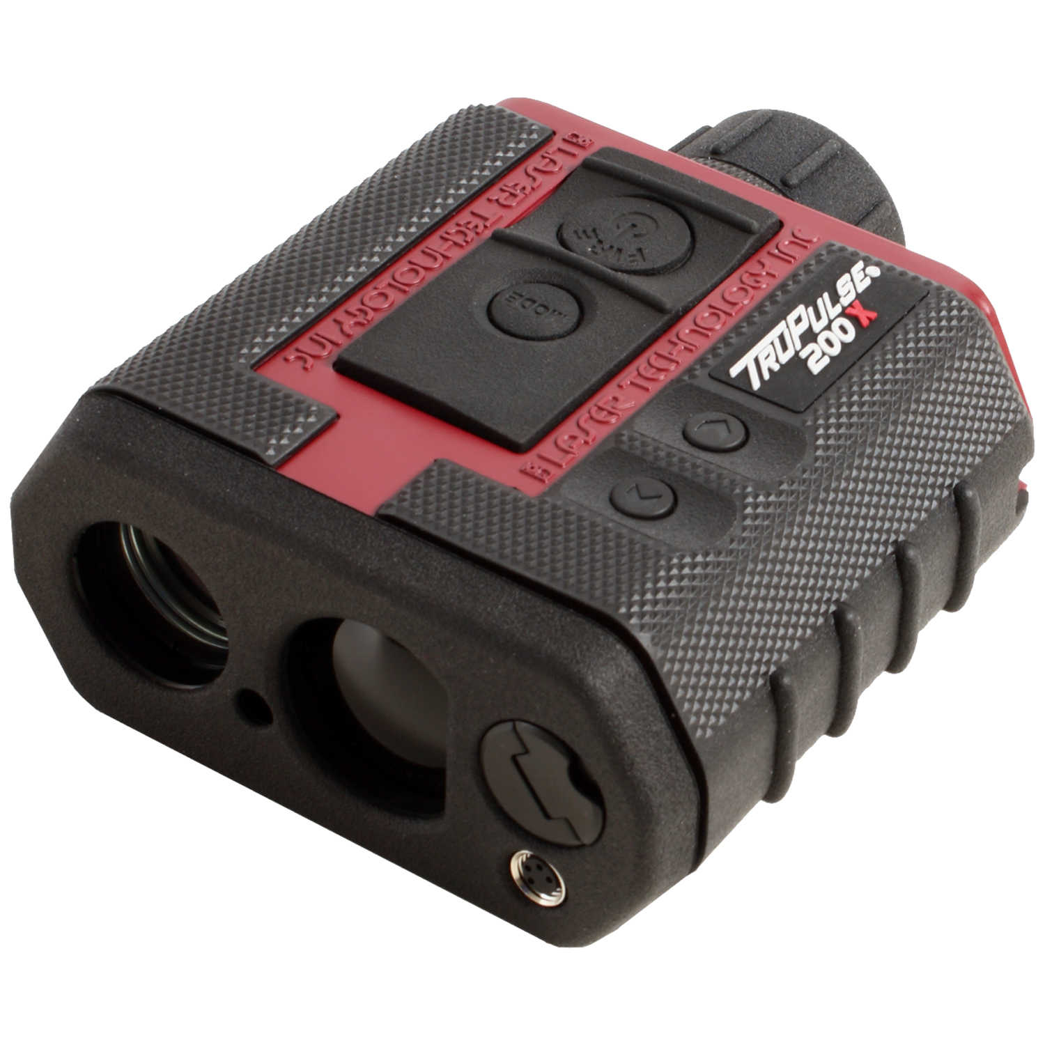
LaserTech Laser Range Finder Model Tru Pulse 200X
The TruPulse 200X model measures distances and heights and is available in LTI red. It comes standard with a serial port, offers in-scope data display with 7x power optics and runs on 1 CR123A battery.
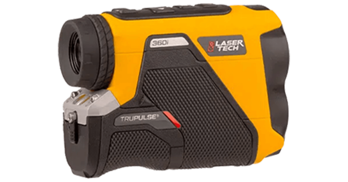
LaserTech Laser Range Finder Model Tru Pulse 360i
The TruPulse® 360𝗂 is a rugged, waterproof rangefinder with TruVector® 360° Compass Technology. It captures accurate 3D data with azimuth, combining tough design and intuitive use for reliable laser measurements anywhere.
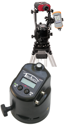
LaserTech MapStar TruAngle (Angle Encoder)
Precisely Measure Horizontal Angles for 3D Measurements.
Precisely calculates a turned horizontal angle that can be referenced to any desired point or direction. When integrated with an LTI laser, you can capture X, Y and Z coordinates for complete 3D mapping and surface modeling.