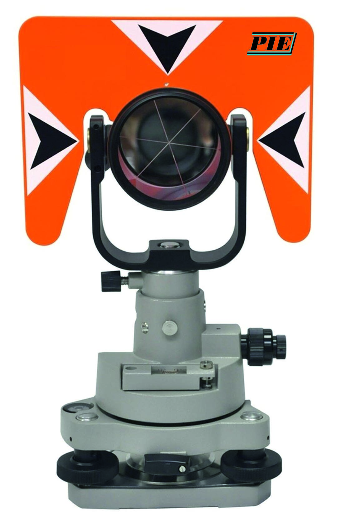
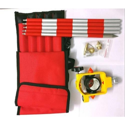
Traversing Kits are used for precise setups and traversing applications – set includes High Precise Tribrach without Optical Plummet, Adapter with Optical Plummet, Prism Set with Holder and Target Plate and PVC box for Prism, Adapter and Tribrach.
2.5X optical plummet
60-second plate vial, adjustable
Precision Adapter -machined axis rotates 360º
Compatible with all prisms with a 24.9 mm bayonet base
Adjustable height:100 mm – 120 mm
Traverse tribrach adapter fits all standard three-prong tribrachs
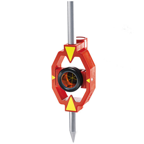
Sokkia Style Mini Prism (1.5 inch dia), multipurpose usage of 0/-30 mm, fit with 5/8″ Prism Pole and 9 mm dia (standard) poles, Silver coated prism having 1.5 inch dia (Approx 35 mm), Twist lock and full sliding type.
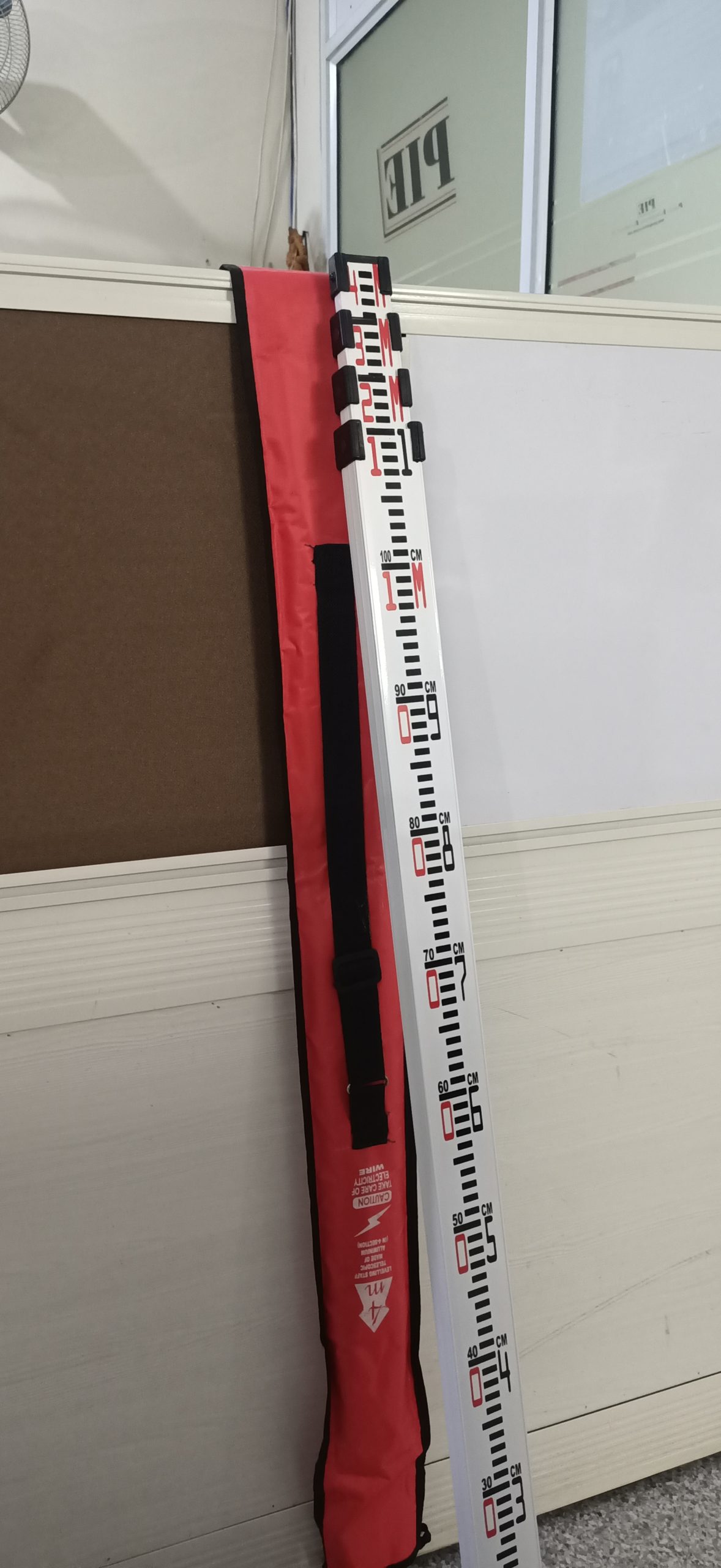
Lightweight and durable telescoping aluminum leveling Staffs. These Staffs have highest wall thickness aluminum to prevent denting and warping, Easy-to-read graduations with measuring scale on the backside for direct reading at eye level
Available in three different sizes
5 Mtr in 5 sections (One side 5 mm standard graduations and other side mm / cm graduations for precise readings) Model ALT-5 (E)
6 Mtr in 5 sections (One side 5 mm standard graduations and other side mm / cm graduations for precise readings) Model ALT-6 (E)
4 Mtr in 4 sections (One side 5 mm standard graduations and other side mm / cm graduations for precise readings) Model ALT-4 (E)
Also available (Myzox, Japan) High Quality imported Levelling Staffs in 4 mtr lengths, standard Indian pattern available (4 mtr long – only one side graduations – long last push button) Model ALM-44 (I)
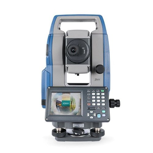
Sokkia FX-201 Total Station is the latest development from Sokkia (Japan make), having a high performance EDM which measures distances upto 1000 meters reflectorless and upto 6000 meters with Single Prism under good weather conditions.
The FX-201 is having high speed measurement to take measurements in less than 1 second time and having accurate results upto. (1.5 mm + 2 ppm) X D, which is one of its kind in any windows series Total Stations.
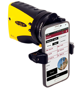
LTI’s touch-screen activated, easy-to-use T&D Pro Field Software along with our reflectorless laser measurement technology makes getting the measurements you need quicker, easier and safer. Verify the sag and tension of multiple power lines, conductor’s clearances, attachment heights and even the direction for a guy wire. The step-by-step graphical aids and instructions were written for non-surveyors, making transmission and distribution tasks a snap. No need to drag around measuring wheels, height sticks or bulky, expensive total stations, just grab a TruPulse laser integrated with T&D Pro software and you’re ready to hit the field!
Instantly calculate critical values and data on the spot, you no longer have to wait to get back to the office. Electronically record and store field data and you can create professional reports and graphs with minimal effort.
T&D Pro Features / Functions
Missing Line & Slope
Applications: To measure span lengths, vegetation clearances, remote slopes and changes in elevation.
Solutions: Follow the step-by-step procedure for shooting in any two remote points, and T&D Pro will instantly calculate the azimuth, inclination and slope distance, as well as measure the horizontal and vertical distance between those two points.
Conductor Clearance
Applications: To determine if a tree is in danger of hitting a conductor if it were to fall.
Solutions: Position yourself either under the conductor or at the tree in question. Measure the tree height and then shoot to the conductor. T&D Pro provides the line clearance value. If it is negative (-), mark the tree to be cut.
Sag Profile
Applications: To verify the span, sag and tension of a conductor.
Solutions: Take multiple shots along the conductor, including both attachment points. In addition, you can map in the ground beneath the span and any other obstructions in the way. T&D Pro instantly calculates the span, sag and tension values for the conductor. It even calculates the height and location of the lowest point.
Conductor Height
Applications: To calculate a conductor’s height aboveground or some other point of reference.
Solutions: Using any of the four measuring methods will always yield an accurate value. Shoot at a point along the conductor and then to a spot below it. T&D Pro instantly displays the height of the wire.
Tie Line Bi-Section
Applications: To locate the direction in which to anchor the guy wire at a bend point in a new line.
Solutions: To determine the direction necessary to anchor the guy wire at a bend point in a new line, occupy the bend point and measure azimuths along both routes. T&D Pro solves for the needed direction.
Store Raw Data
Applications: Logging miscellaneous distance, angles, heights, etc.
Solutions: You can log miscellaneous distances, angles, heights and other data simply by shooting to an object and sending the data string to T&D Pro. Notations can be stored along with the data.
MapSmart field data collection software is designed for anyone who needs to quickly and accurately map, measure, or position anything. It’s a simple yet powerful program that easily integrates with LTI laser devices and mapping accessories to turn a laser into a complete total station solution.
This program was specifically designed to be easy to operate so more time can be spent mapping and collecting data rather than training. Choose to include GPS origin and offset coordinates with laser-based mapping or not. If you do, you only need to capture one perfect coordinate – all the others are mathematically calculated based on that position. You can also choose to map using only GPS or seamlessly move between laser mapping and GPS mapping in one project.
Experience the Freedom of BYOD (Bring Your Own Device)
Laser
LTI offers diverse laser options to fit any situation – MapSmart works with them all. To map fast and easy, choose the TruPulse 360B or TruPulse 360R with integrated compass technology.
To achieve higher accuracy and conquer environments wrought with magnetic interference; choose the TruPulse 200X laser rangefinder with MapStar TruAngle.
When size matters, the Trupoint 300 is compact and versatile and provides millimeter accuracy for closer-proximity surveys or asset management projects.
Data Collector
You can use almost any Android phone, tablet, or ruggedized device (such as the CT7G offered by Laser Technology) you may even already have to collect and store your measurement data.
GIS Accuracy
MapSmart can incorporate GPS coordinates to meet any error budget. Depending on your GIS requirements for the job, use the GPS data from your Android device’s Location Services OR pair a higher accuracy GPS device to your Android device and bypass Location Services. If you need one, these devices can be purchased from Laser Technology Authorized Partners.
Drafting/Visualization
Complete the mapping solution with finished printed surveys using IMS Map360 (offered by LTI) – OR use the drafting program that you already have. With GPS surveys, import and view .KML files and .GPX format data in just about any GIS visualization program (including ArcGIS). Other report formats include .DXF, .CSV, .PDF, .TXT, and .ASC and can be easily emailed from your Android device to any destination.
Mapping Solutions with MapSmartMapSmart Measuring Stockpile Volume
Achieve Quick & Safe Volume Measurements
Keeping track of inventories has never been easier. Use MapSmart to find out the volume of any size stockpile (including stockpiles in bins of various shapes) OR use it to find out how much material you need to fill a hole right in the field. Use your Android device to add a photo of the stockpile to any measurement and include one in a PDF report (with or without XYZ coordinates).
MapSmart Field Calculation Screen Shots
Get Instant Field Calculations
MapSmart can make several calculations right in the field that can be saved for later or can even eliminate the need for post-processing:
To ease the process of decrypting field measurement at the end of the day, MapSmart provides many options for organizing and classifying data points. First, every measurement can have a unique note that is entered at the time OR selected from a user-defined list. Second, categories (Example: Status or Tree Species) and subcategories (Example: Good, Fair, Poor or Ponderosa Pine, Aspen, Blue Spruce) can be built and assigned to a data point. Third, a height (Example: Attachment Point on a utility pole) or missing line (Example: Distance from pole to danger tree) measurement may be applied to a data point with an additional note for each. Include photos taken with the Android device or the TruPoint 300.Measuring with MapSmart and the TruPoint 300
Map Points, Lines, Curves, & Areas
Keep the survey simple and map in just points or connect the points with a line, spline curve, or area feature as you go.
Review & Edit Points & Features
If at any time a measurement is in question, easily review the coordinates and notes associated with each collected data point with the Point Detail feature. Edit any points in the field, review raw measurements or notes for each point, and view all the measurement values in a tabular format.
Access Built-in Help at any Time
Use MapSmart Help to easily catch and correct the most common mapping mistakes and to better understand how to set up and execute all of the available mapping methods. Refer to Help’s “Move Control Point” section for a reminder of the process of moving your equipment position for larger surveys.
Note: MapSmart is also available on Windows Mobile, see Program features tab for differences.
Need to capture and record measurements with pictures of each shot? Well, we have an app for that! Our LaserSoft Measure App makes taking field measurements as easy as 1-2-3, and it stores scope shot images and files them any way you want.
Key Features of LaserSoft Measure App:
Makes data collection easy for non-GIS experts
Stores 7X scope shot images and all laser data values
Record LTI TruPulse scope shots & data values for:
Distances (HD, SD, VD) and Inclination
Height and Missing Line solutions
Azimuth (TruPulse 360B and 360R models only)
Customizable categories, subcategories and notes for all your measurements.
Remote trigger capability (both inside and outside the Measure Module)
Create and review multiple projects.
Available for Android & iOS (Apple) devices
Connect with Bluetooth®
LaserSoft Measure App is available for both iOS (Apple) and Android devices. See the specifications tab for pertinent information for your device.
NOTE: No data plan required.
*iOS version only communicates with LTI’s TruPulse 200X Bluetooth model.


 MapSmart Measuring Stockpile Volume
 Measuring with MapSmart and the TruPoint 300