Map, Measure, & Position Smarter
MapSmart field data collection software is designed for anyone who needs to quickly and accurately map, measure, or position anything. It’s a simple yet powerful program that easily integrates with LTI laser devices and mapping accessories to turn a laser into a complete total station solution.
This program was specifically designed to be easy to operate so more time can be spent mapping and collecting data rather than training. Choose to include GPS origin and offset coordinates with laser-based mapping or not. If you do, you only need to capture one perfect coordinate – all the others are mathematically calculated based on that position. You can also choose to map using only GPS or seamlessly move between laser mapping and GPS mapping in one project.
Experience the Freedom of BYOD
(Bring Your Own Device)
Laser
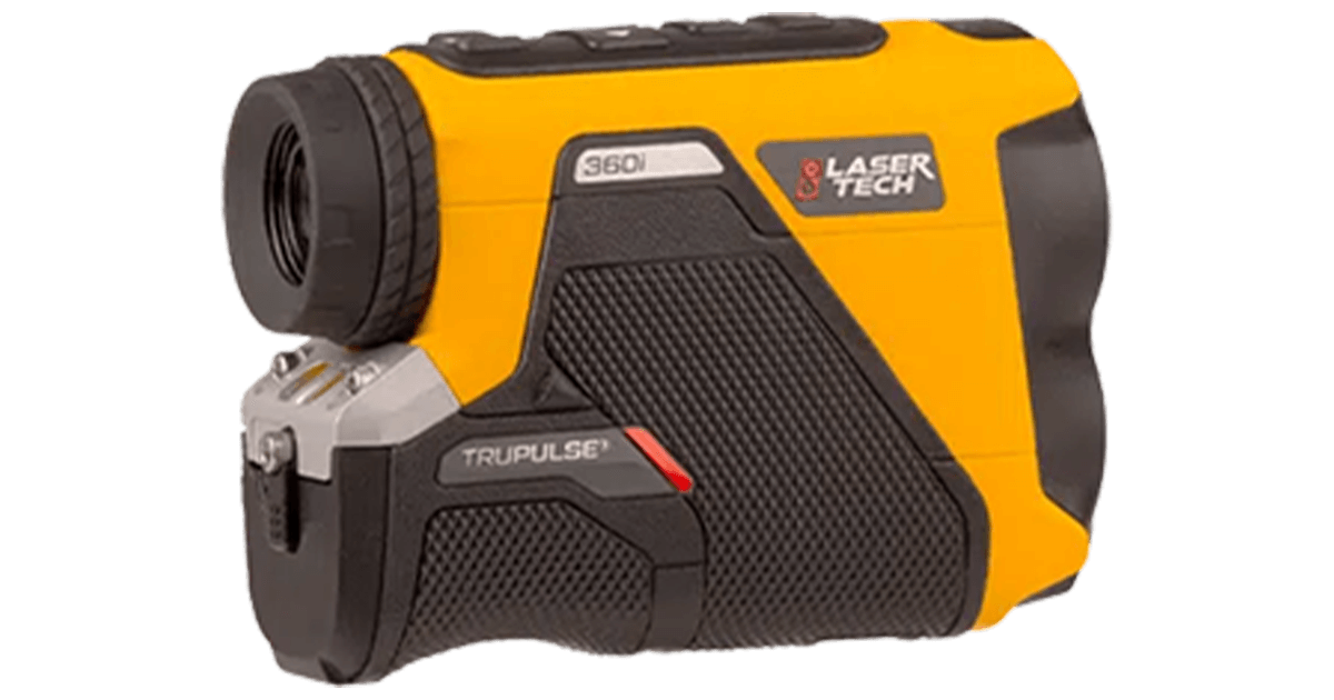
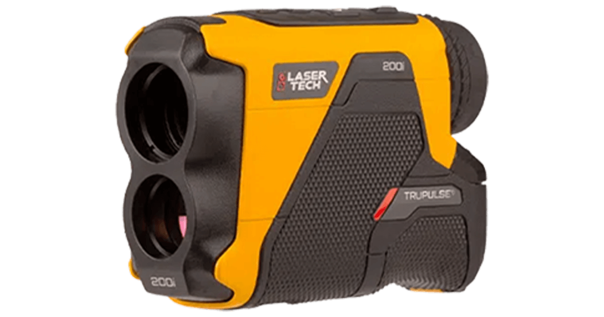
LTI offers diverse laser options to fit any situation – MapSmart works with them all. To map fast and easy, choose the TruPulse 360B or TruPulse 360R with integrated compass technology.
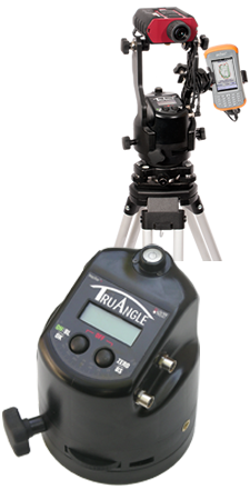
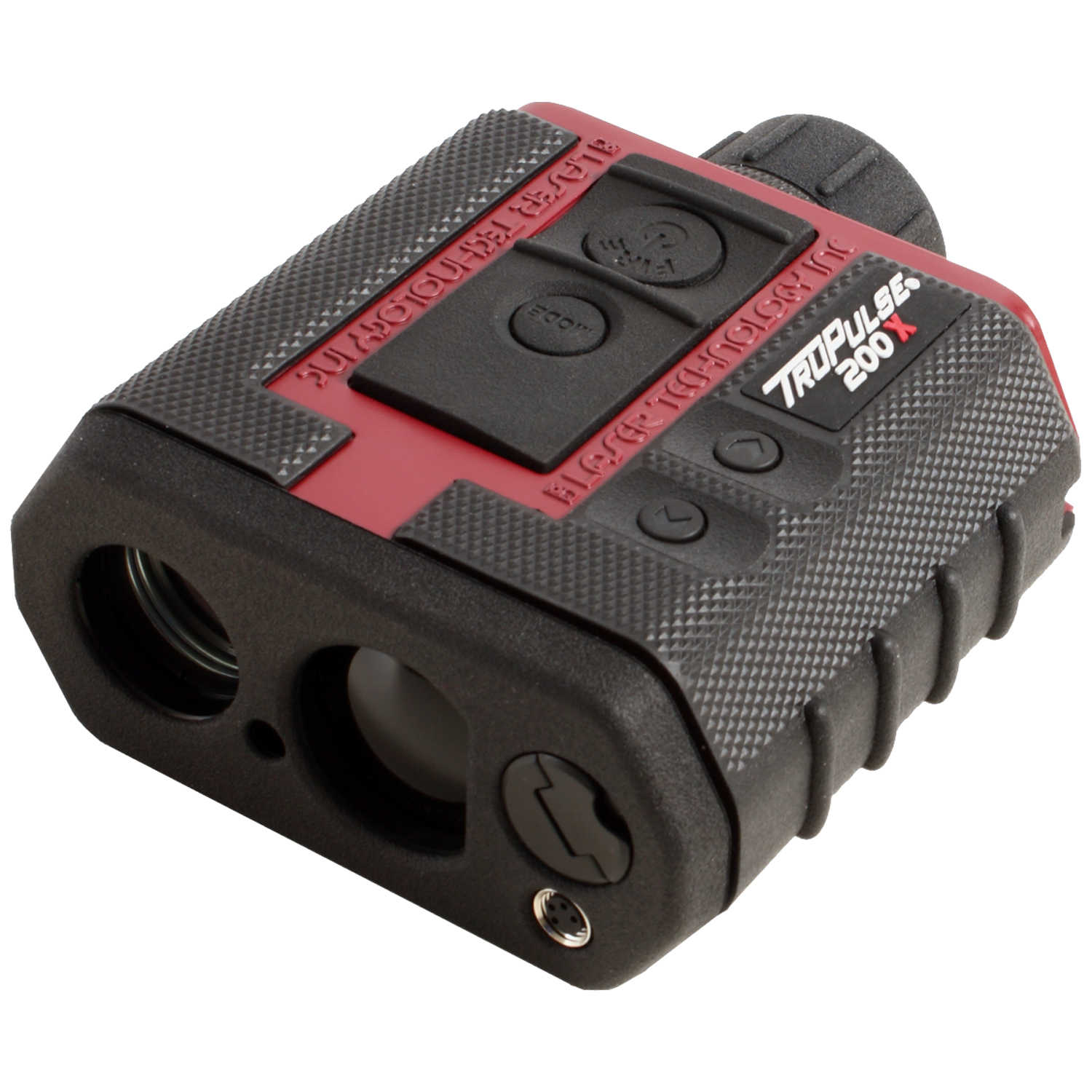
To achieve higher accuracy and conquer environments wrought with magnetic interference; choose the TruPulse 200X laser rangefinder with MapStar TruAngle.
When size matters, the Trupoint 300 is compact and versatile and provides millimeter accuracy for closer-proximity surveys or asset management projects.
Data Collector
You can use almost any Android phone, tablet, or ruggedized device (such as the CT7G offered by Laser Technology) you may even already have to collect and store your measurement data.
GIS Accuracy
MapSmart can incorporate GPS coordinates to meet any error budget. Depending on your GIS requirements for the job, use the GPS data from your Android device’s Location Services OR pair a higher accuracy GPS device to your Android device and bypass Location Services. If you need one, these devices can be purchased from Laser Technology Authorized Partners.
Drafting/Visualization
Complete the mapping solution with finished printed surveys using IMS Map360 (offered by LTI) – OR use the drafting program that you already have. With GPS surveys, import and view .KML files and .GPX format data in just about any GIS visualization program (including ArcGIS). Other report formats include .DXF, .CSV, .PDF, .TXT, and .ASC and can be easily emailed from your Android device to any destination.
Mapping Solutions with MapSmart MapSmart Measuring Stockpile Volume
Achieve Quick & Safe Volume Measurements
Keeping track of inventories has never been easier. Use MapSmart to find out the volume of any size stockpile (including stockpiles in bins of various shapes) OR use it to find out how much material you need to fill a hole right in the field. Use your Android device to add a photo of the stockpile to any measurement and include one in a PDF report (with or without XYZ coordinates).
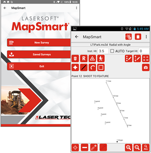
MapSmart Field Calculation Screen Shots
Get Instant Field Calculations
MapSmart can make several calculations right in the field that can be saved for later or can even eliminate the need for post-processing:
- Area (All Points, Side Shots, Feature, Traverse)
- Closure (Open or Closed Traverse Error)
- Height
- Missing Line
- Point to Point/Point to Line
- Volume
Assign Unique Notes, Measurements, Classifications & Photos
To ease the process of decrypting field measurement at the end of the day, MapSmart provides many options for organizing and classifying data points. First, every measurement can have a unique note that is entered at the time OR selected from a user-defined list. Second, categories (Example: Status or Tree Species) and subcategories (Example: Good, Fair, Poor or Ponderosa Pine, Aspen, Blue Spruce) can be built and assigned to a data point. Third, a height (Example: Attachment Point on a utility pole) or missing line (Example: Distance from pole to danger tree) measurement may be applied to a data point with an additional note for each. Include photos taken with the Android device or the TruPoint 300. Measuring with MapSmart and the TruPoint 300

Map Points, Lines, Curves, & Areas
Keep the survey simple and map in just points or connect the points with a line, spline curve, or area feature as you go.

Review & Edit Points & Features
If at any time a measurement is in question, easily review the coordinates and notes associated with each collected data point with the Point Detail feature. Edit any points in the field, review raw measurements or notes for each point, and view all the measurement values in a tabular format.

Access Built-in Help at any Time
Use MapSmart Help to easily catch and correct the most common mapping mistakes and to better understand how to set up and execute all of the available mapping methods. Refer to Help’s “Move Control Point” section for a reminder of the process of moving your equipment position for larger surveys.
Note: MapSmart is also available on Windows Mobile, see Program features tab for differences.