Geode Real Time Sub Meter GPS Receiver

Juniper Systems, Geode

Looking for a simple sub-meter GNSS solution at an affordable price? With the Geode, you can easily collect real-time, sub-meter GNSS data without the huge price tag or complexity of other precision receivers.

Designed with versatility in mind, the Geode works with iPhone and iPad as well as a wide range of Windows®, Windows Mobile, and Android™ devices and is especially useful for bring-your-own-device workplaces.

Take the Geode with you mounted on a pole, in a pack, or held in your hand to collect real-time sub-meter GNSS data in harsh environments, using almost any handheld device.

SUBMETER ACCURACY
Use the Geode with a handheld device to easily collect sub-meter GNSS data
REAL-TIME DATA
The Geode uses multiple correction sources to provide precise, real-time data
AFFORDABLE
Get the professional accuracy you need at a budget-friendly price
ALL-IN-ONE
Inside, the Geode contains both receiver and antenna, providing an all-in-one GNSS solution
COMPACT SIZE
The Geode is small and lightweight — easy to pack around for all-day use
OPEN INTERFACE
Use the Geode with any of Juniper Systems’ handhelds or your own iPhone, iPad, Windows, or Android device
ALL-DAY BATTERY LIFE
Overtime Technology battery is ideal for long workdays and conserves power in extreme temperatures
JUNIPER RUGGED
Designed to withstand harsh environments for consistently reliable performance
SIMPLE TO USE
Intuitive and easy operation — one-button simplicity

Satlab GNSS Receiver Model SL-900

SL900 GNSS Receiver solution

The SatLab GNSS receiver is a high-precision that performs even under the most demanding conditions. With this GNSS Receiver. it is capable of delivering highly accurate gps data in real-time to any devices via a Bluetooth connection. Satellite correction service,compact and lightweight, this RTK GNSS is one of the most flexible solutions that promises positioning reliability.

Tilt compensation solution

With surveyors in mind, SatLab GNSS designed a solution to increase efficiency in your workflow by cutting down time wasted from offsetting slanted measurements. With the tilt compensator and GNSS antenna, the GNSS Receiver can save up to 20 percent of time compared to conventional surveying practices. This GNSS solution allows you to focus on your surroundings conveniently while ensuring your safety and comfort.

Efficient and dependable

Powered by NovAtel OEM729 GNSS engine, this receiver offers precise positioning and advanced interference mitigation which performs even in the most remote or challenging environments. Using its 555 channel tracking capabilities, it can track all current and upcoming signals, offering sub-metre excellently to centimetre precise positioning with different modes (RTK, PPK, Static).

Satellite correction service

The GNSS Receiver has TerraStar capabilities that use a global network of multi-GNSS reference stations and advanced algorithms to generate highly precise GNSS satellite orbit, clock, biases, and other system parameters. These data allow TerraStar to provide correction services with sub-metre or centimetre-level positioning accuracy to receivers. Get your corrections transmitted in real-time, with minimal latency via satellites and cellular networks worldwide.

Positioning
GPS:L1C/A, L2E, L2C, L5
GLONASS:L1C/A, L1P, L2C/A, L3 CDMA
Galileo:E1, E5A, E5B, E5AltBOC, E6
BeiDou:B1, B2, B3
SBAS:L1C/A, L5 QZSS, WAAS, MSAS, GAGAN, EGNOS
IRNSS:L5
QZSS:L1 C/A, L2C, L5
L-Band:OmniSTAR, Trimble RTX (optional)
Channels:336
Performance
Real-time Kinematic:H: 8 mm + 1 ppm RMS / V: 15 mm + 1 ppm RMS
Network RTK:H: 8 mm + 0.5 ppm RMS / V: 15 mm + 0.5 ppm RMS
Post Processing Kinematic:H: 8 mm + 1 ppm RMS / V: 15 mm + 1 ppm RMS
High-precision Static:H: 2.5 mm + 0.1 ppm RMS / V: 3.5 mm + 0.4 ppm RMS
Static and Fast Static:H: 2.5 mm + 0.5 ppm RMS / V: 5 mm + 0.5 ppm RMS
DGPS Position Accuracy:H: 25 cm RMS / V: 50 cm RMS
SBAS Position Accuracy:H: 50 cm RMS / V: 85 cm RMS
Code Differential:DGPS/RTCM
Initializing Time:2-10 s
Initializing Reliability:99.9%
Tilt Compensation:4 cm accuracy in the inclination of 30°
Physical
Size:170 mm x 95 mm
Weight:1.2 kg (including battery)
Battery:5,000mAh Lithium-Ion Battery
Battery Life:10 hours (RTK Rover)
Environmental
Environmental Protection:IP67
Water:Waterproof to 1 m (3.28 ft) depth
Shock/Vibration:MIL-STD-810G, 514.6
2 m (6.5 ft) pole drop
Operating Temperature:-40 °C to +65 °C
Storage Temperature:-40 °C to +85 °C

Satlab GNSS Receiver, Model SL-700

SL700 Gnss Receiver 

GNSS Receiver is an easy-to-use gnss device that is designed to be compact and rugged for your everyday surveying usage. Made to withstand the harshest weather conditions, the SL700 performs with great mobility and flexibility. This innovative receiver delivers the most accurate results in the most efficient way for your fieldwork.

New and improved innovation technology

Powered by multi-constellation tracking, SL700 offers accurate and precise results with improved performance. Armed with a NovAtel OEM729 GNSS engine, this GNSS Receiver features a multi-device interface depending on your application which boosts your productivity and efficiency. UHF Radio and GSM RTK inbuilt mode.

Efficient and dependable

Powered by NovAtel OEM729 GNSS engine, this receiver offers precise positioning and advanced interference mitigation which performs even in the most remote or challenging environments. Using its 555 channel tracking capabilities, it can track all current and upcoming signals, offering sub-metre to centimetre precise positioning with different modes (RTK, PPK, Static).

Satellite correction service

The SL700 has TerraStar capabilities that use a global network of multi-GNSS reference stations and advanced algorithms to generate highly precise GNSS satellite orbit, clock, biases, and other system parameters. These data allow TerraStar to provide correction services with sub-metre or centimetre-level positioning accuracy to SL700 receivers. Get your corrections transmitted in real-time, with minimal latency via satellites and cellular networks worldwide.

Technical Specifications

Channel Information
GPS:L1C/A, L1C, L2C, L2P, L5
GLONASS:L1C/A, L2C, L2P, L3, L5
Galileo:E1, E5AltBOC, E5a, E5b, E6
BeiDou:B1, B2, B3
SBAS:L1, L5
IRNSS:L5
QZSS:L1C/A, L1C, L2C, L5, L6
L-Band:Up to 5 Channels (TerraStar)
Physical
Battery:5,000mAh Lithium-Ion Battery
Battery Life:10 hours (Static Measurement / RTK Rover)
Weight:1.4kg including battery
Dimensions:164 mm x 83.5 mm
Environmental
Environmental Protection:IP67
Operating Temperature:-40 °C to +65 °C
Storage Temperature:-40 °C to +85 °C

Sokkia GNSS Receiver, Model GRX-3

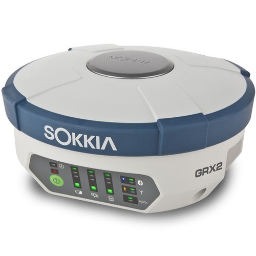
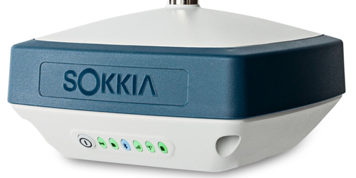
The Sokkia GRX3 is smaller, lighter, and packed with the most advanced GNSS technology in a design built to withstand the harshest field environments.  All signals, all satellites and all constellations —  in a compact, rugged design, with an integrated IMU and eCompass.

Sokkia Tilt Technology :Incorporates a revolutionary 9-axis inertial measurement unit (IMU) and ultra-compact eCompass, which compensate for mis-leveling up to 15 degrees.

  • Sokkia Tilt Technology 
  • L Band Ready Technology
  • 226 Universal Tracking Channels (GPS, GLONASS, Galileo, BeiDou, IRNSS, QZSS, SBAS)
  • Bluetooth and GSM RTK (Magnet Relay)
  • Fusion Positioning™ technology
Number of Universal Tracking Channels226 UTC technology
Tracked SignalsGPS L1 C/A, L1C, L2P(Y), L2C, L5
GLONASS L1 C/A, L1P, L2 C/A, L2P, L3C
BeiDou B1, B2
Galileo E1,E5a, E5b, Alt-BOC
SBAS L1 C/A, L5 WAAS/MSAS/EGNOS/GAGAN
QZSS L1 C/A, L1C, L1-SAIF, L2C, L5
Static/Fast StaticH: 3 mm + 0.4 ppm
V: 5 mm + 0.5 ppm*
MemoryInternal Non-removable 8 GB
RTK OptionsBluetooth and GSM RTK (Magnet Relay)
Dust/Water ProtectionIP67
Dimensions150 x 100 x 150 mm (w x h x d)
Operating TimeApprox 10 to 12 hrs continuous Tracking

Sokkia GNSS Receiver, Model GRX-2

GRX2 Features :The GRX2 receiver is a fully integrated dual constellation receiver, antenna, radio, and optional cellular modem. In addition, the integrated Bluetooth module, now enhanced for better performance, is designed into a rugged magnesium alloy body.
 
Fully Scalable ArchitectureGRX2’s scalable architecture maximizes your return on investment. It allows you to start with an L1 GPS receiver with a minimal initial cost, which can be upgraded to L1 GPS+GLONASS, to L1/L2 GPS, up to 226-channel L1/L2 GPS+GLONASS receiver at any time you need.
226 Channels for GPS + GLONASS + SBAS
226 tracking channels with Universal Tracking Technology are available for GPS, GLONASS and SBAS signals tracking.Supports GPS L2C signals.
Other Hardware Features :
22 status LED displays are exceptionally viewable

Number of Channels226
Tracked SignalsGPS, Glonass, Galileo, SBAS
Accuracy (RTK)H: 10mm + 1ppm  V: 15mm + 1ppm
Communication PortsBluetooth, Serial, SD/SDHD
Wireless CommunicationMagnet Relay for GSM and External Radio for Radio RTK
Dust/Water ProtectionIP67
SizeDia. 184 x H95mm
Weight: GRX2/BDC70 battery1kg / 195g
Operating Temperature (with BDC70)-20 to +65C
Operating Time> 7.5 hours in static mode with Bluetooth Operation