LaserTech MapStar TruAngle (Angle Encoder)

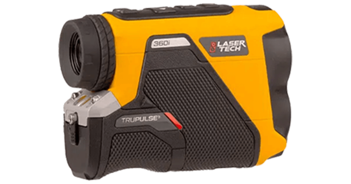
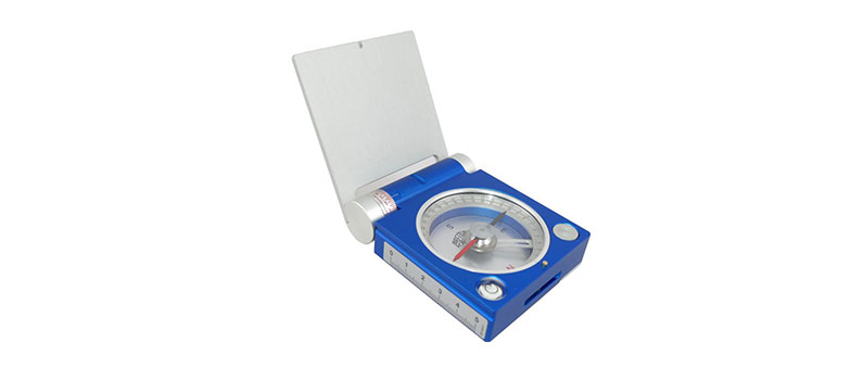
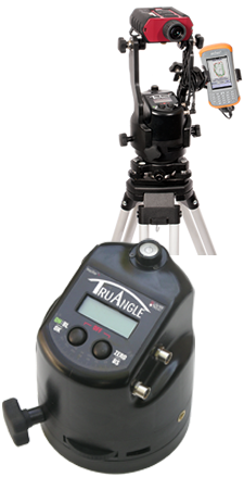
The MapStar TruAngle, precisely calculates a turned horizontal angle that can be referenced to any desired point or direction. When integrated with an LTI laser, you can capture X, Y and Z coordinates for complete 3D mapping and surface modeling. With a smaller and lighter weight design, a more simplistic user interface and a price point that’s nearly half of the MSAE, the TruAngle angle encoder is an attractive alternative mapping accessory.

When mounted on a tripod, the TruAngle angle encoder is capable of producing +/- 0.05 degrees in angular accuracy. There is a built-in mechanical bubble to assist with leveling it correctly and a friction lock mechanism that helps you take more precise measurements. All the angular values can be clearly seen, day or night, with the easy to read numbers and backlit LCD.

Since the user interface has been simplified, anyone can take the lead in capturing accurate field data. It’s as simple as leveling the device, aiming towards a point or direction and setting the initial angle value to zero. All the data collected thereafter is simply referenced from that initial predetermined direction. The laser data goes through the TruAngle angle encoder and then automatically outputs your 3D coordinates directly into a data collector. The serial output format is compatible with most GIS field data collection software and GPS/GNNS products. 

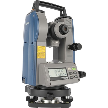
This system is a great alternative to using a total station because you won’t need to invest a lot of time with extensive training or make a huge upfront financial investment. Our modular design also allows you to use the laser standalone so you can become more mobile when taking just distance and height measurements.

If you need to map within urban environments or nearby heavy equipment or buildings, the TruAngle angle encoder is the perfect tool because it is unaffected by local magnetic interference. You never have to worry about your angular accuracy being compromised in these areas. Get the basic angular values you need at the price point that will pay for itself in time savings alone.

How the MapStar TruAngle Measures Up:

  • Offers a low price point without compromising needed functionality
  • Operates easily with a simple 2 button interface to decrease field time and aggravation
  • Provides industry leading angular accuracy to ensure quality maps every time
  • Includes a mechanical bubble so you can set up quickly and obtain the best accuracy
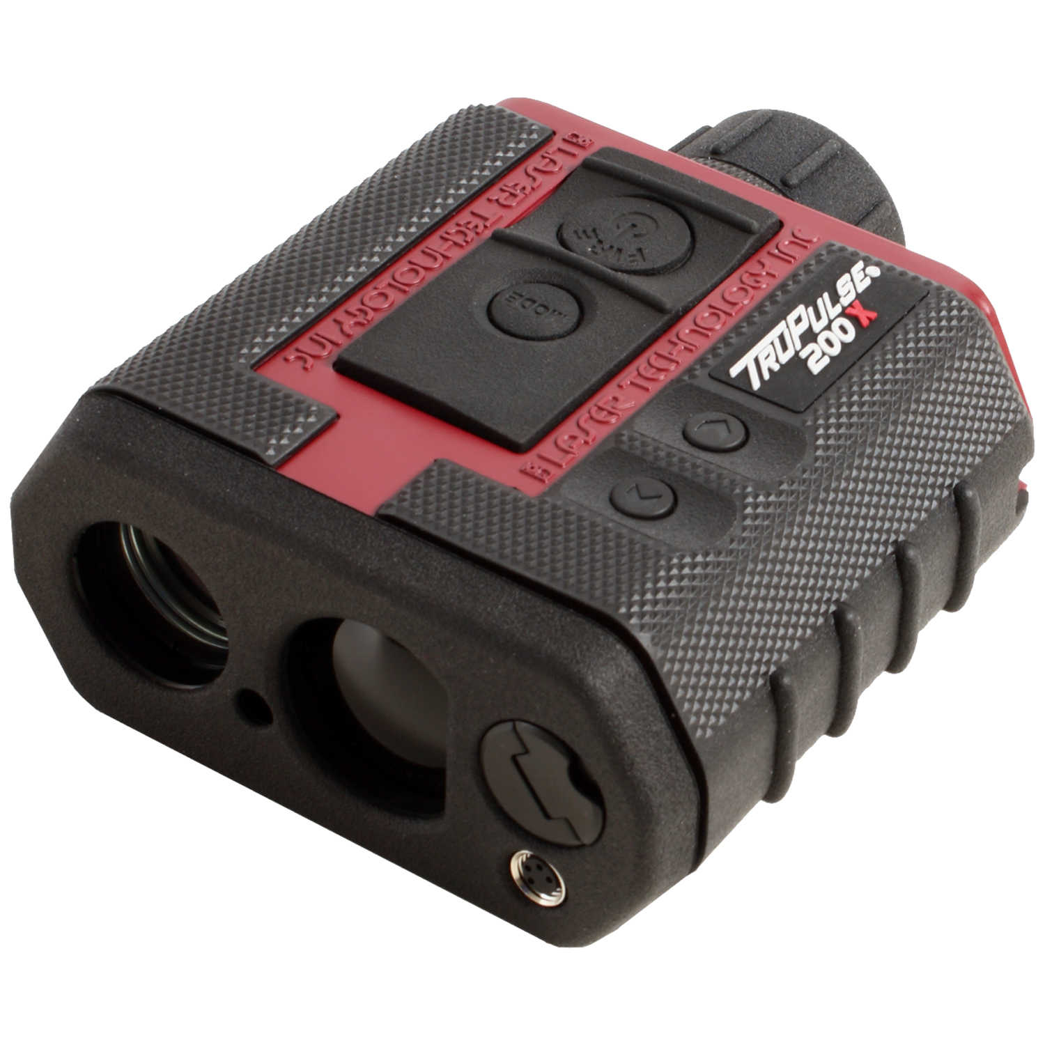
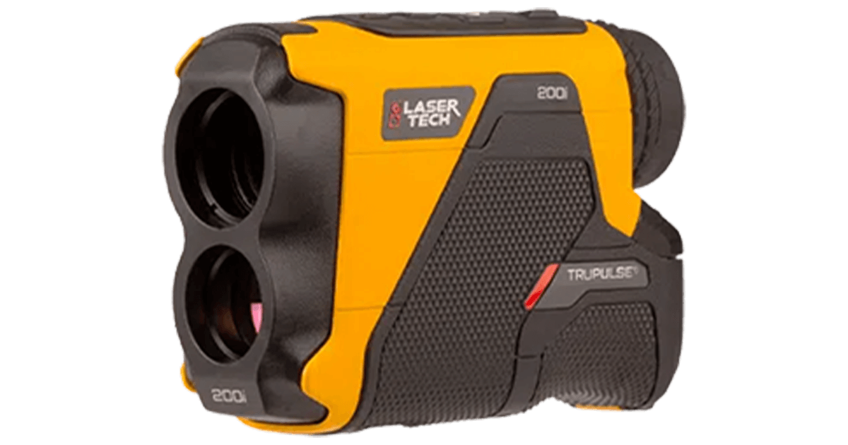
  • Integrates seamlessly with all LTI laser rangefinders

Specific Uses/Functions 
Weight: 1.0 kg (2.25 lbs)
Size: 14.2 x 11.7 x 11.7 cm (5.6 x 4.6 x 4.6 in)
Sensor Type: Encoder; unaffected by local magnetic interference
Angle Accuracy when Staff Mounted:± 0.1 deg
Angle Accuracy when Tripod Mounted:± 0.05 deg
Data Range:0 to 359.99 deg
Data Resolution:0.01 deg
Data Ouput:RS232, NMEA
Temperature Range:-30° to +50° C (-22° to +122° F)    
Power Supply / Usage Consumption: (2) AA (Up to 8 hours of use)

Or CRV3 (Up to 12 hours of use)
Construction:Fiberglass-filled polycarbonate
Environment:IP 54, NEMA 3
Fine Adjust Wheel Ratio:66:1
Communication:RS232 Serial, BLF*
Tripod Mount:5/8″ threaded insert
Adapters available: 5/8 x 11 to 1/4 x 20 F insert, 5/8 x 11 to 3/8 x 16 F insert
Susceptible to Magnetic Interference:No
Built-in Friction Lock Mechanism:Yes
Leveling:Mechanical bubble level

Key Features of MapStar TruAngle:

  • Integrates with all LTI lasers to generate 3D measurements.
  • Permits easy viewing of all your measurements on the custom backlit LCD display. 
  • Offers dual serial ports for communication in from the laser and out to data collectors.
  • Indicates battery life at all times.
  • Allows you to easily calibrate sensors with on-board routines.
  • Includes a download cable.

Bluetooth® Loop* Function for MapStar TruAngle:

The MapStar TruAngle now has a Bluetooth® Encoder Loop feature that syncs with selected LTI TruPulse Bluetooth® laser rangefinders. It eliminates a cable by adding the horizontal angle measurement to the laser’s data string.

NOTE: All specifications are subject to change without notice.

LaserTech Laser Range Finder Model Tru Pulse 360R

TruPulse 360R Laser Rangefinder

The newly released TruPulse 360R offers all the same functionality and specifications as the 360 model, but with a rugged waterproof horizontal design for the harsher environments.

Key Enhancements of the TruPulse 360R include:
  • 33% more range accuracy
  • 25% better target acquisition
  • Increased Azimuth Accuracy
  • Bluetooth® communication included
Key Features of the TruPulse 360R include:
  • Provides full measurement capability with AZ + INC + SD
  • Calculates Horizontal Distance (HD) + Vertical Distance (VD) + Height (HT) + 3D Missing Line (ML)
  • Solves 3D missing line calculations between any two remote points
  • Distinguishes desired target from surrounding obstructions with Closest + Farthest + Continuous + Filter modes
  • Mounts to tripods and has quality optics that enhance your field of view
  • Integrates with GPS for efficient GIS data capture
Key Features of LTI TruVector 360° Compass Technology:
  • Produces accurate and repeatable Azimuth (AZ) results regardless of the tilt or pitch you use to aim the laser
  • Recognizes conditions that will affect the reliability of the compass accuracy and prompts you to recalibrate
  • Calibrates easily with a simple field routine that can be completed in less than a minute
Key Features In All TruPulse Laser Rangefinders:
  • Measures Slope Distance (SD) + Inclination (INC) in Degrees or Percent
  • Calculates Horizontal Distance (HD) + Vertical Distance (VD) + Height (HT) + 2D Missing Line (ML)
  • Distinguishes desired target from surrounding obstructions with Closest + Farthest + Continuous + Filter modes
  • Mounts to tripods and has quality optics that enhance your field of view

LaserTech Laser Range Finder Model Tru Pulse 200X

TruPulse 200X Laser Rangefinder

The TruPulse 200X model measures distances and heights and is available in LTI red. It comes standard with a serial port, offers in-scope data display with 7x power optics and runs on 1 CR123A battery.

Key Features of the TruPulse 200X include:
  • Achieves the highest distance and inclination accuracy
  • Adjusts to varying lighting conditions using the in-scope LED display
  • Withstands harsh conditions with rugged, waterproof housing
Key Features In All TruPulse Laser Rangefinders:
  • Measures Slope Distance (SD) + Inclination (INC) in Degrees or Percent
  • Calculates Horizontal Distance (HD) + Vertical Distance (VD) + Height (HT) + 2D Missing Line (ML)
  • Distinguishes desired target from surrounding obstructions with Closest + Farthest + Continuous + Filter modes
  • Mounts to tripods and has quality optics that enhance your field of view

LaserTech Laser Range Finder Model Tru Pulse 200

TruPulse 200 Laser Rangefinder

The newly released TruPulse 200 model measures more than just distance and angle. This laser comes with new and improved enhancements offering users sophisticated cutting-edge technology along with the easy to operate and accuracy that LTI lasers are known for.

Key Features and Enhancements:
  • 33% more accurate
  • 25% better target acquisition
  • Wireless communication
  • Crystal-clear 7-power optics
  • Adjustable eye diopter
  • TruTargeting Technology
Key Features In All TruPulse Laser Rangefinders:
  • Measures Slope Distance (SD) + Inclination (INC) in Degrees or Percent
  • Calculates Horizontal Distance (HD) + Vertical Distance (VD) + Height (HT) + 2D Missing Line (ML)
  • Distinguishes desired target from surrounding obstructions with Closest + Farthest + Continuous + Filter modes
  • Mounts to tripods and has quality optics that enhance your field of view

Sokkia Electronic Theodolites, DT-50 Series

Sokkia Electronic Theodolite Model DT50 Series is a lightweight, latest and compact Instrument. Alignment and angular measurement device which boasts up to 30 work days of power with the rechargeable battery; the highest water and dust protection in its category; and convenient, high-precision laser guidance.

  • High-accuracy measurements (5”, 7” and 9” models)
  • Ultra-rugged IP66 dust and heavy rain protection 
  • Compact and light weight  
  • Long-lasting Li-ion or AA battery life 
  • Easy-to-use LCD backlit display(s) 
  • Precise laser pointer guidance 
  • Embedded tilt sensor for 5” and 7” models
Angle measurement5″, 7″, 9″
Tilt compensationIncluded in 5″ and 7″ models
Operating Time (4 AA alkaline batteries) theodolite only~ 230 hours
Operating time (Li-Ion) theodolite only~ 300 hours
Ingress ProtectionDust and water resistance IP66
Operating temperature range-20 to 50°C (-4 to 122°F)
Storage temperature range-30 to 60°C (-22 to 140°F) (no condensation)
Size (with handle)5″ and 7″ Models: 173 (W) X 181 (D) X 318 (H) mm
9″ Models: 173 (W) X 174 (D) X 318 (H) mm
Weight (with batteries and battery holder)5″ and 7″ Models: 4.1 kg (9.04 lb)
9″ Models: 4.0 kg (8.82 lb)”

Breithaupt Kassel, Germany Clar Compass Gekom N Pro/ Gekom Pro

  • Measurement and reading of azimuth of dip and angle of dip in one single operation (according to Clar method)
  • Inclination adjustable
  • Inner circle diameter 48mm with interval of graduation 2°
  • Reading by estimation 1°
  • Dip measurement range 270° graduated in 5°
  • Reading by estimation 1°
  • Circular spirit level
  • Integrated clinometer ±90°
  • Mirror for observing needle during sighting process
  • Waterproof one-piece housing
  • Declination adjustment without opening the housing

Fiber Glass Leveling Staffs

  • Non-conductive (under dry conditions) telescoping fiberglass leveling rod
  • Easy-to-read graduations with a special measuring scale on the backside, permits user to read height at eye level
  • All sections have common button system for easy replacement if needed
  • Includes: carrying case
5 Meter Leveling StaffFiber 5 meter in 5 sections
7 Meter Levelling Staff7 Meter in 6 Sections

Sokkia GNSS Receiver, Model GRX-3

The Sokkia GRX3 is smaller, lighter, and packed with the most advanced GNSS technology in a design built to withstand the harshest field environments.  All signals, all satellites and all constellations —  in a compact, rugged design, with an integrated IMU and eCompass.

Sokkia Tilt Technology :Incorporates a revolutionary 9-axis inertial measurement unit (IMU) and ultra-compact eCompass, which compensate for mis-leveling up to 15 degrees.

  • Sokkia Tilt Technology 
  • L Band Ready Technology
  • 226 Universal Tracking Channels (GPS, GLONASS, Galileo, BeiDou, IRNSS, QZSS, SBAS)
  • Bluetooth and GSM RTK (Magnet Relay)
  • Fusion Positioning™ technology
Number of Universal Tracking Channels226 UTC technology
Tracked SignalsGPS L1 C/A, L1C, L2P(Y), L2C, L5
GLONASS L1 C/A, L1P, L2 C/A, L2P, L3C
BeiDou B1, B2
Galileo E1,E5a, E5b, Alt-BOC
SBAS L1 C/A, L5 WAAS/MSAS/EGNOS/GAGAN
QZSS L1 C/A, L1C, L1-SAIF, L2C, L5
Static/Fast StaticH: 3 mm + 0.4 ppm
V: 5 mm + 0.5 ppm*
MemoryInternal Non-removable 8 GB
RTK OptionsBluetooth and GSM RTK (Magnet Relay)
Dust/Water ProtectionIP67
Dimensions150 x 100 x 150 mm (w x h x d)
Operating TimeApprox 10 to 12 hrs continuous Tracking

Sokkia GNSS Receiver, Model GRX-2

GRX2 Features :The GRX2 receiver is a fully integrated dual constellation receiver, antenna, radio, and optional cellular modem. In addition, the integrated Bluetooth module, now enhanced for better performance, is designed into a rugged magnesium alloy body.
 
Fully Scalable ArchitectureGRX2’s scalable architecture maximizes your return on investment. It allows you to start with an L1 GPS receiver with a minimal initial cost, which can be upgraded to L1 GPS+GLONASS, to L1/L2 GPS, up to 226-channel L1/L2 GPS+GLONASS receiver at any time you need.
226 Channels for GPS + GLONASS + SBAS
226 tracking channels with Universal Tracking Technology are available for GPS, GLONASS and SBAS signals tracking.Supports GPS L2C signals.
Other Hardware Features :
22 status LED displays are exceptionally viewable

Number of Channels226
Tracked SignalsGPS, Glonass, Galileo, SBAS
Accuracy (RTK)H: 10mm + 1ppm  V: 15mm + 1ppm
Communication PortsBluetooth, Serial, SD/SDHD
Wireless CommunicationMagnet Relay for GSM and External Radio for Radio RTK
Dust/Water ProtectionIP67
SizeDia. 184 x H95mm
Weight: GRX2/BDC70 battery1kg / 195g
Operating Temperature (with BDC70)-20 to +65C
Operating Time> 7.5 hours in static mode with Bluetooth Operation

Sokkia IM -100 Series Total Station, Model IM-101/ Model IM-105

Key Features of Sokkia IM105/Sokkkia IM101 Reflectorless Total Station

With Sokkia IM-105 Total Station /Sokkia IM-101 Total Station you get fast, accurate, and powerful EDM technology, best-in-class accuracy up to 6,000 meter with a prism and up to 1000 meter in reflectorless mode, and a battery life of up to 28 hours. The iM-100 series intelligent measurement station is ready to be your hardest worker out in the field.

Construction and Survey Application Software Reliable All-Round Total Station

Cross-Sectional Survey
By using the MLM (Missing Line Measurement) program, the height difference between points can be calculated. Also, you can save time on reflectorless mode to measure a number of points of variation in a large area.

Stake Out
The Guide Light function will navigate the prism operator to move to the stake out line quickly so that stake out operation can be done effectively.

Elevation Stake
Staking out with 3D coordinates, eliminates the need to set up TS on the straight line for all elevation stakes.

Boundary and Cadastral Survey
By using the Area function, you can calculate the area easily. Also, you can determine the center point of the column such as electric pole, which cannot be directly measured, by using offset calculation.

Coordinate Measurement
With coordinate measurement, you can manage 3D coordinate data so that various calculations such as Road, Layout and more can be determined. 3D coordinate data management can improve the productivity drastically.

Topographic Survey
The trigger key, or measuring distance key, helps you perform topography quickly while continuously viewing through the telescope. Also, the long distance measuring range reduces the number of the instrument changes for more efficient working time.

Improve Topography and Stake Out, with features to achieve faster and more efficient workflows

Sokkia iM-100 Series Total Station Features

IoT Support System – Connect the Site and the Office

TSshield IoT Support System

  • Remotely update the firmware via the internet
  • Improves asset management by checking TS operating time
  • Remote Lock secures the instrument from theft.
  • Monitor TS heath status to enable quick reaction against any functionality issues

Superior Basic Feature will Expand Your Application

Strong Environmental Spec
The IP66 rating ensures durability for most any rough job site temperatures and conditions.

Long Hours Operation
One battery lasts up to 28 hours, or about four days of normal operation time.

Bright Illumination Key for Nighttime Work
Key buttons are illuminated to minimize mistakes.

Reliable Large Volume Memory
Internal memory has 50,000 points to record.
USB memory can be used up to 32GB.

Japan Quality Products
We perform the tough environmental tests to ensure long-term operation even under the rough site environments. Sokkia iM 100 Series total stations are thoroughly inspected with dust-proof and water-proof test chambers.

In addition, the various tests against vibration, drop, temperature, and humidity were successfully passed to achieve the best environmental spec. Also, the measuring distance accuracy test on base line and the instrument leveling and angle accuracy test and adjustment by collimator system ensure your satisfaction on iM Series product quality.

Sokkia Total Station iM105 Technical Specifications:

ModeliM105 Sokkia Total Station
Telescope
Magnification / Resolving Power30x / 2.5″
Length171mm (6.7in.)
Objective aperture45mm (48mm for EDM)
ImageErect
Field of View1°30′ (26m / 1,000m)
Minimum focus1.3m
Reticle illumination5 brightness levels
Angle Measurement
Display Resolution1″/5″ (IM-101)
0.5″/1″ (IM-105)
Accuracy (ISO 17123-3:20015″ (IM-105)
1″ (IM-101)
Dual Axis CompensatorDual-axis liquid tilt sensor, working range: ±6′
 Collimation CompensationOn/Off (selectable)
Distance Measurement
Laser output (Reflectorless mode)Class 3R / Prism / sheet mode: Class 1
Range reflectorless mode0.3 to 800m (2,620ft.) / Under good conditions*: 1,000m (3,280ft.)
Reflective sheetRS90N-K: 1.3 to 500m (4.3 to 1,640ft.), RS50N-K: 1.3 to 300m (4.3 to 980ft.),
RS10N-K: 1.3 to 100m (4.3 to 320ft.)
Mini Prism1.3 to 500m (4.3 to 1,640ft.)
One Prism1.3 to 5,000m (4.3 to 16,400ft.) / Under good conditions* : 6,000m (19,680ft.)
Display ResolutionFine / Rapid : 0.0001m (0.001ft. / 1/16 in.) / 0.001m (0.005ft. / 1/8 in.) (selectable)
Tracking / Road : 0.001m (0.005ft. / 1/8 in.) / 0.01m (0.02ft. / 1/2 in.) (selectable)
AccuracyReflectorless: (2 + 2ppm x D) mm
Reflective Sheet: (2 + 2ppm x D) mm
Prism Mode: (1.5 + 2ppm x D) mm
Measuring Time
Fine Measurement Mode0.9 sec.(Intial 1.5 sec.)
Rapid Measurement Mode0.6 sec.(Intial 1.3 sec.)
Tracking Measurement Mode0.4 sec.(Intial 1.3 sec.)
OS, Interface and Data Management
Operating systemLinux
Display / KeyboardGraphic LCD, 192 x 80 dots, backlight, contrast adjustment / Alphanumeric keyboard / 28 keys with backlight
Control panel locationOn both faces
Trigger keyYes (right side)
Data storageInternal memory: Approx. 50,000 points
Plug-in memory device: USB flash memory (max. 32GB)
InterfaceSerial RS-232C, USB2.0 (Type A for USB flash memory)
Bluetooth® modem (option)Bluetooth Class 1.5, Operating range: up to 10m
General
Laser pointerCoaxial red laser using EDM beam
Guide lightGreen LED (524nm) and Red LED (626nm), Operating range: 1.3 to 150m (4.3 to 490ft.)
Levels Graphic6′ (Inner Circle)
Circular Level10’/2mm
Optical PlummetMagnification: 3x
Minimum focus: 0.5m from tribrach bottom
Dust and water protectionIP66 (IEC 60529:2001)
Operatig temperature-4ºF to +122ºF (-20ºC to +50ºC)
Size with handle (w x d x h mm)183(W)x 181(D)x 348(H)mm
Weight with battery and tribrachApprox. 5.3kg (11.7lb)
Power Supply
Battery (BDC70) Detachable batteryLi-ion rechargeable battery
Operating time (20ºC) BDC70Approx. 28 hours (single distance measurement every 30 seconds)